PATCHWORK BRITAIN
ENVIRONMENT
2019

A self-directed textile installation and publication examining the UK's catastrophic loss of biodiversity through landscape as archive.
Patchwork Britain began with an uncomfortable realisation: when the International Union for Conservation of Nature assessed global biodiversity, the UK ranked so poorly that two additional protected area categories had to be created to include British 'national parks.' Our iconic countryside—the patchwork of fields we imagine as quintessentially British—is actually an ecological desert, the result of intensive agriculture that has stripped the landscape of wild complexity.
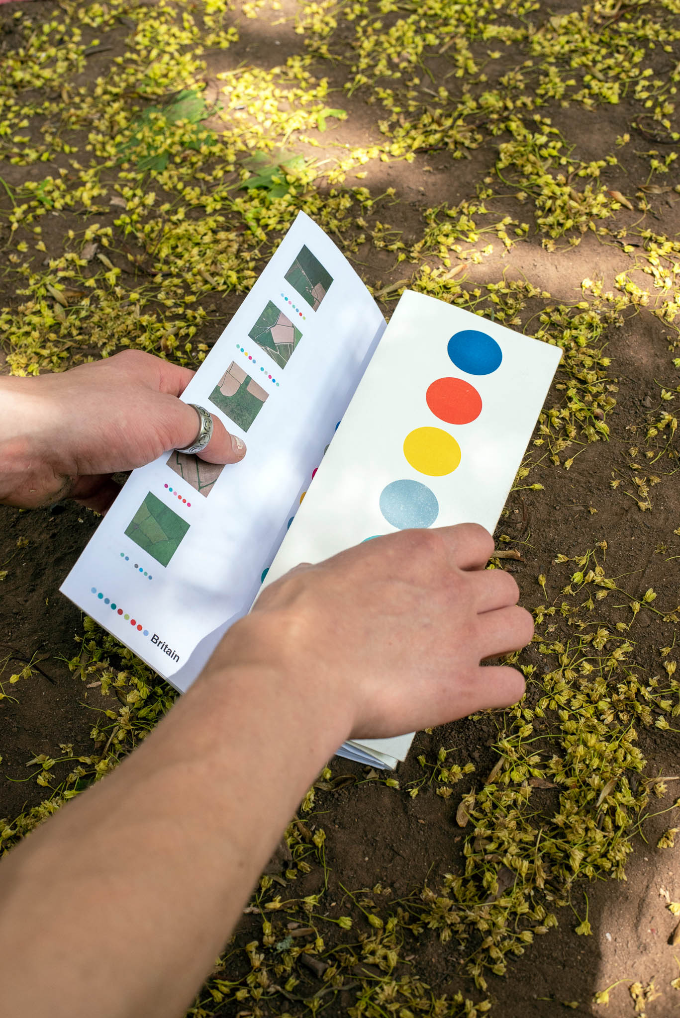
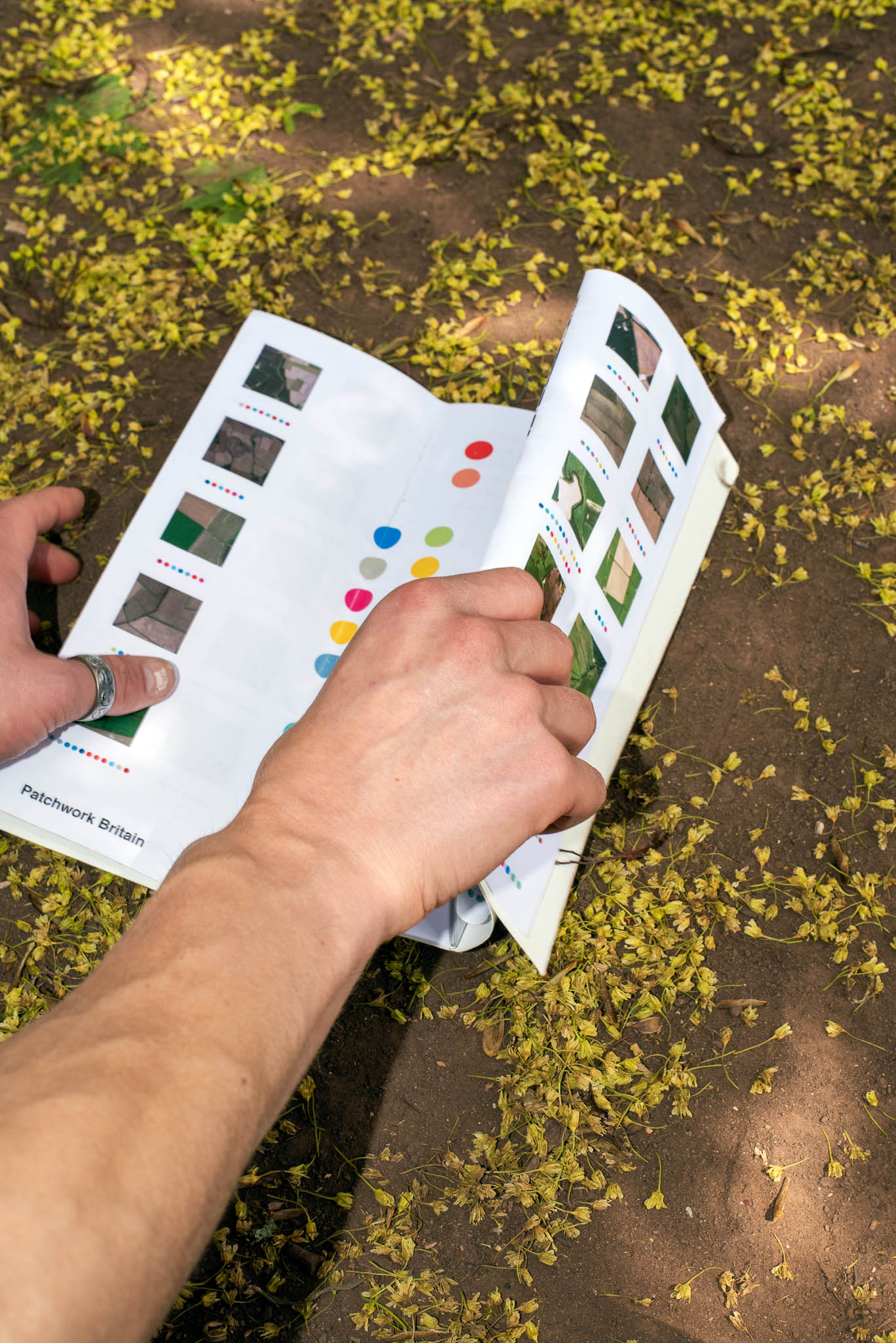
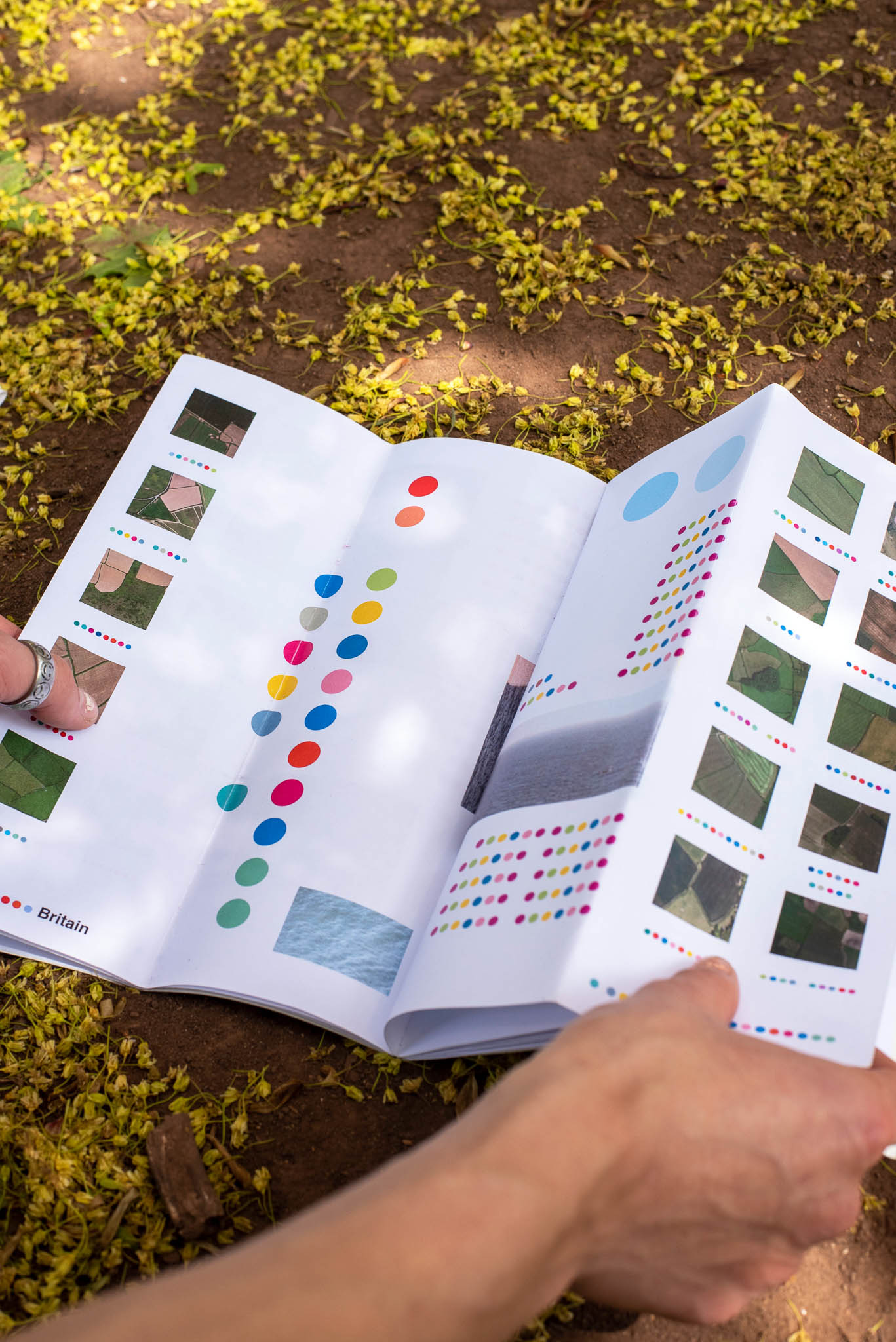
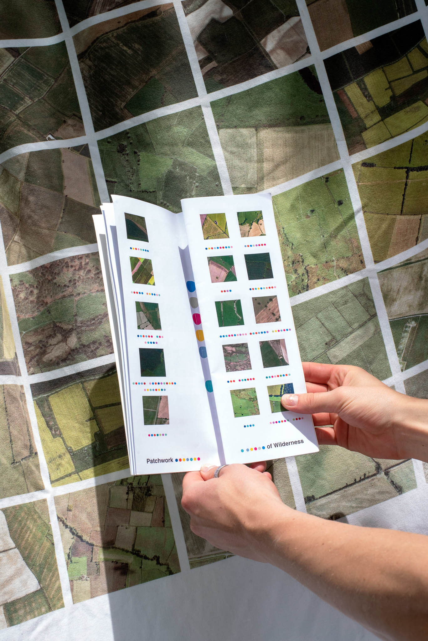
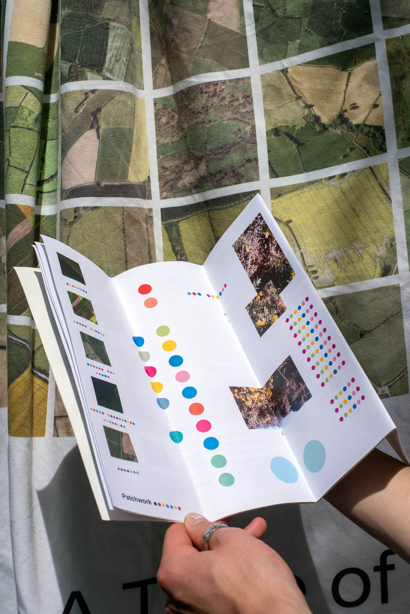
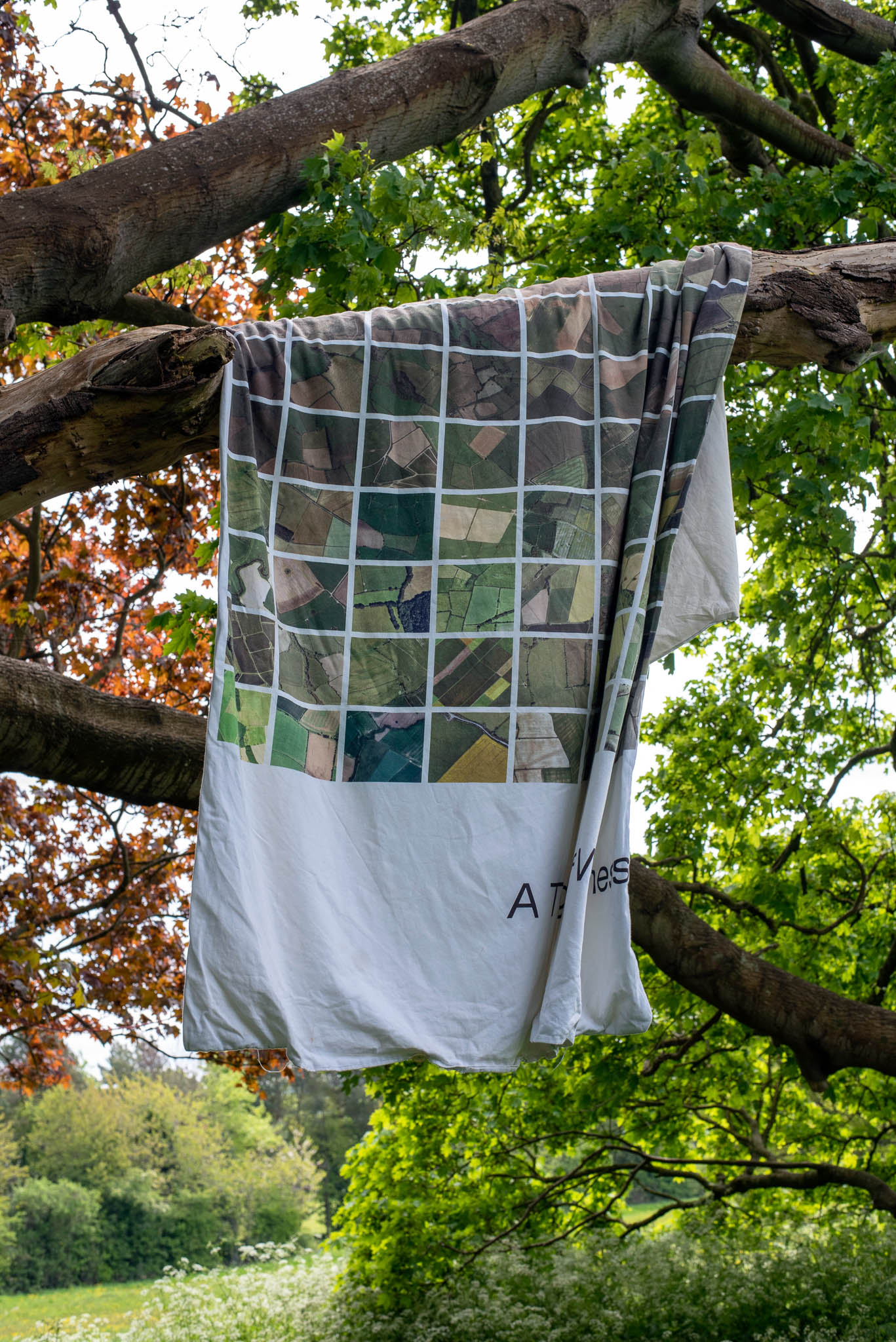
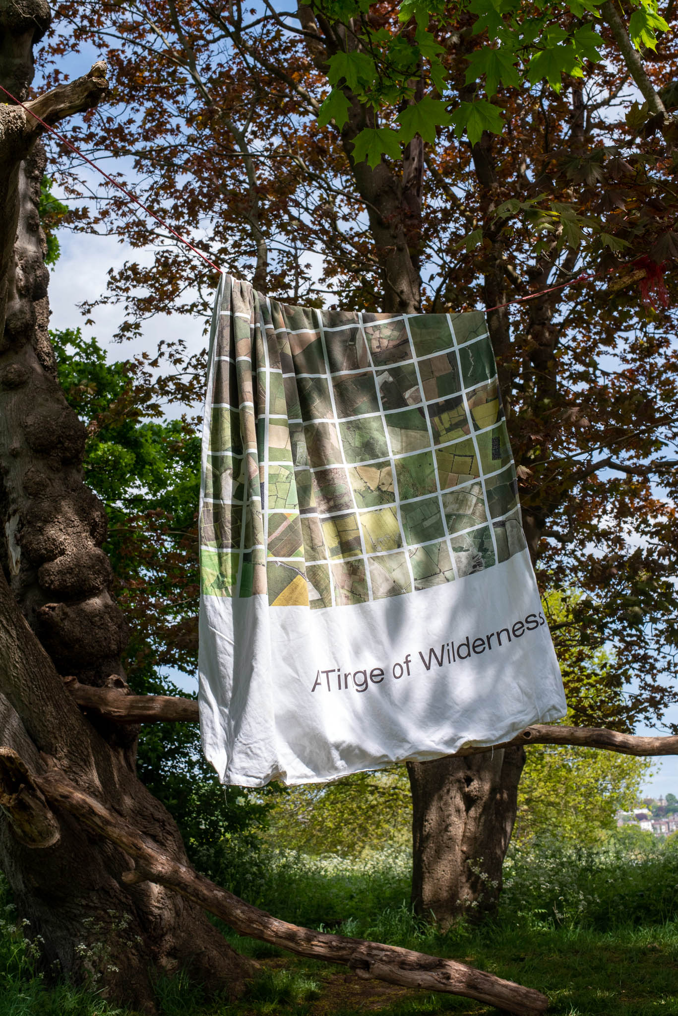
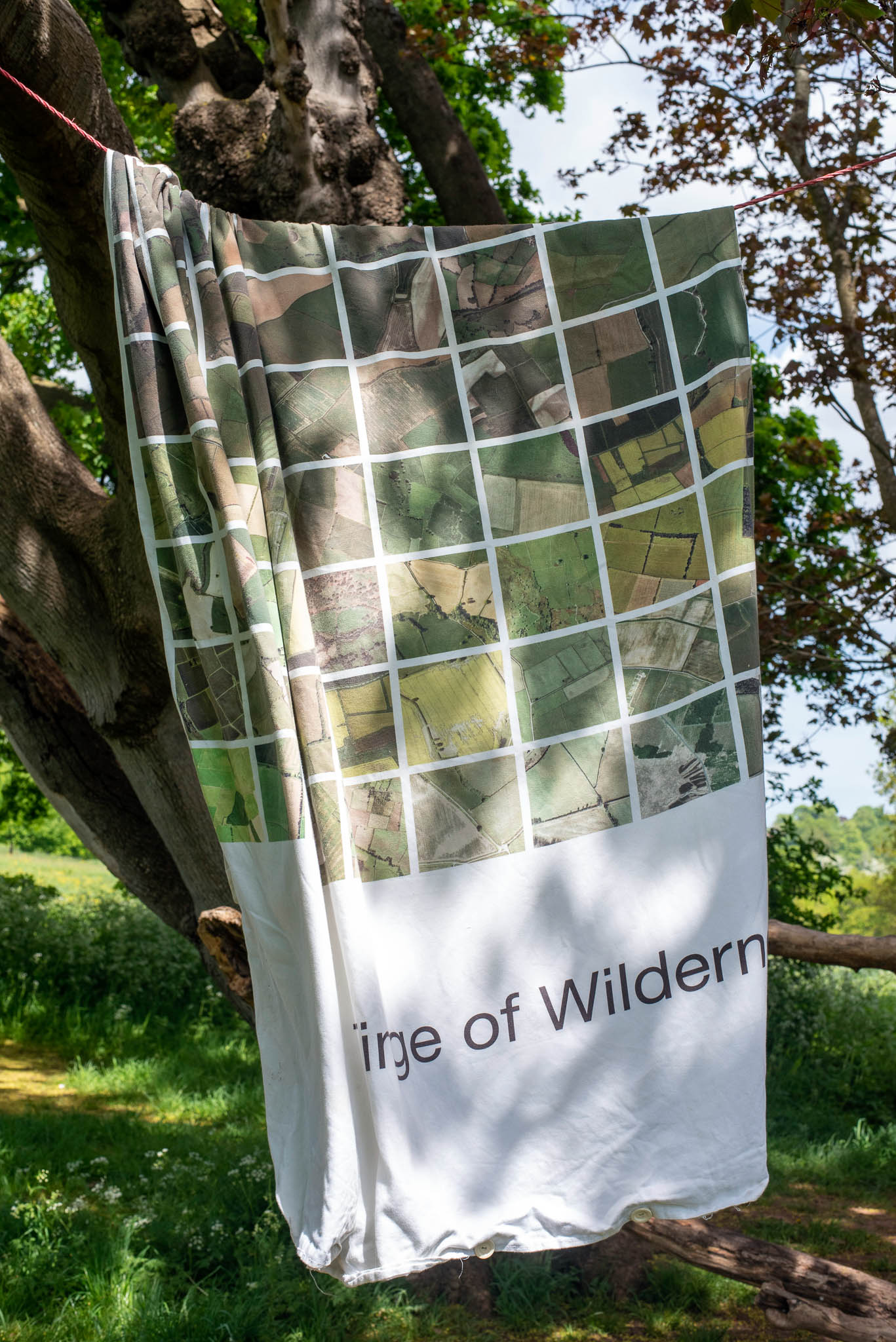
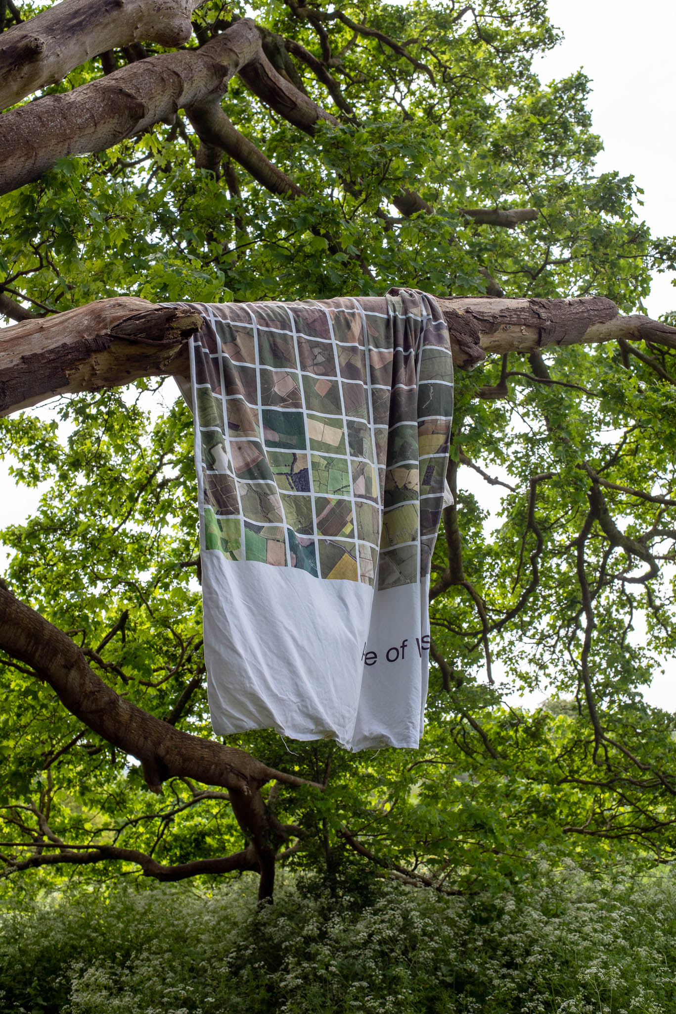
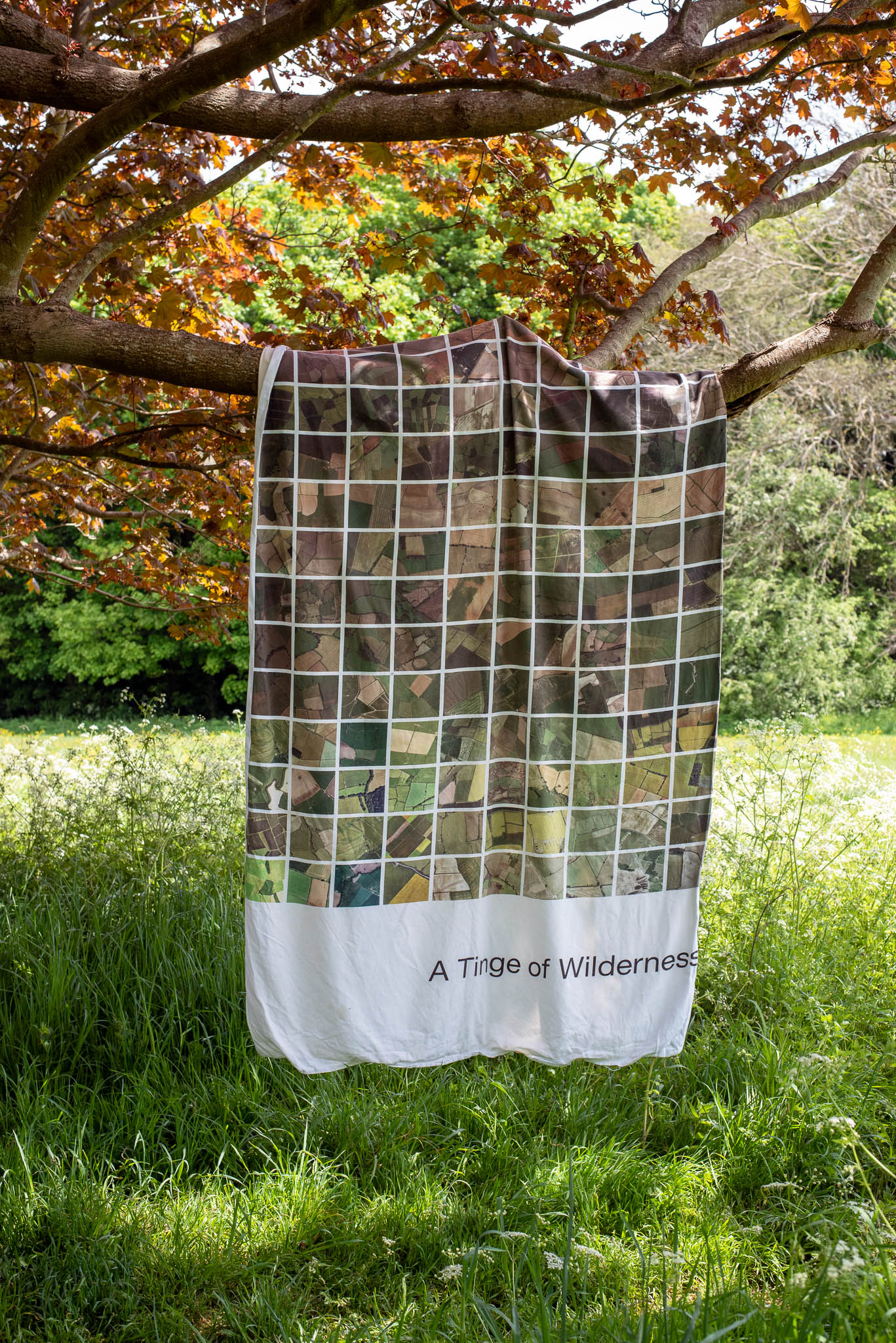
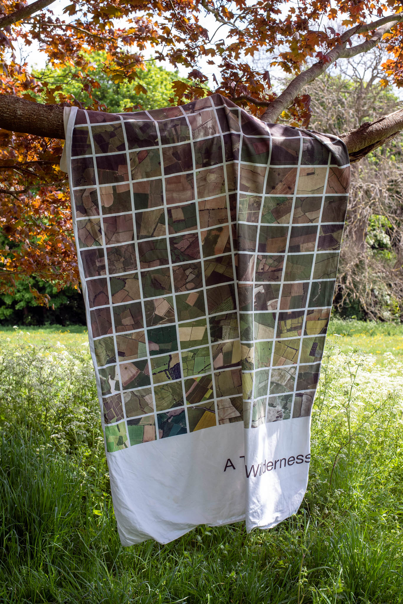
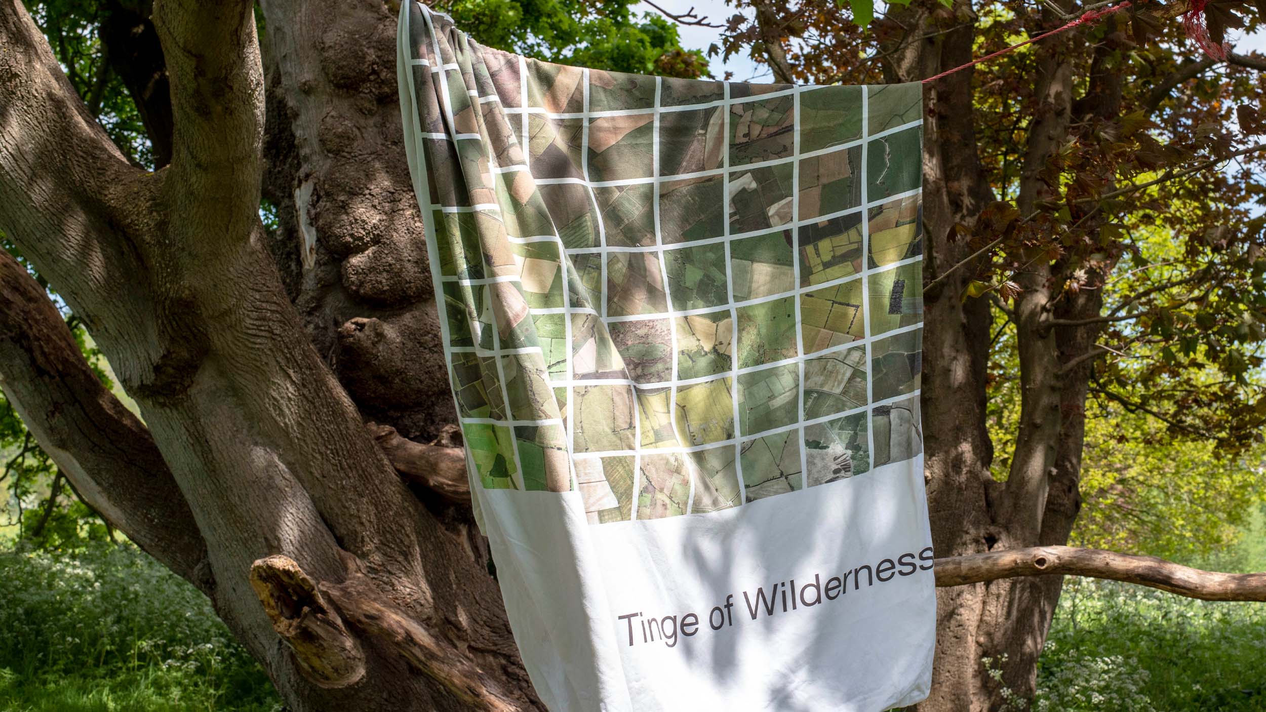
The project uses Google Maps satellite imagery of fields across England, Scotland, Wales, and Northern Ireland, revealing a topography that literally resembles a quilt: geometric, cultivated, controlled. These images were translated into a large-scale textile piece that modernises the archaic British patchwork tradition—but instead of comfort, it documents loss.
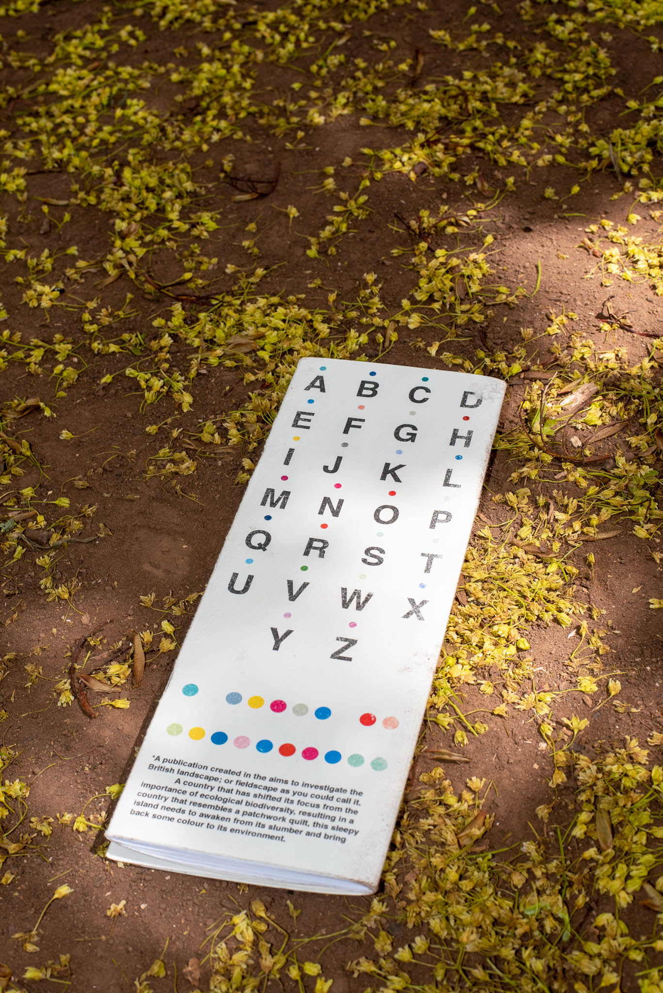
The accompanying publication creates a deliberate contrast: field imagery on the outer pages, biodiverse landscapes hidden inside the fold. A custom glyph font (Colour Dot) encodes location names, requiring the viewer to decode each site—an interaction that mirrors our disconnection from the land itself. The binding is playful and tactile, creating intimacy with a difficult subject.
The work asks: what have we lost in creating this 'idyllic' landscape? And what would it mean to let it become wild again?
The project uses Google Maps satellite imagery of fields across England, Scotland, Wales, and Northern Ireland, revealing a topography that literally resembles a quilt: geometric, cultivated, controlled. These images were translated into a large-scale textile piece that modernises the archaic British patchwork tradition—but instead of comfort, it documents loss.
The accompanying publication creates a deliberate contrast: field imagery on the outer pages, biodiverse landscapes hidden inside the fold. A custom glyph font (Colour Dot) encodes location names, requiring the viewer to decode each site—an interaction that mirrors our disconnection from the land itself. The binding is playful and tactile, creating intimacy with a difficult subject.
The work asks: what have we lost in creating this 'idyllic' landscape? And what would it mean to let it become wild again?